
The clay trail takes you through the woodland and around the Blackwater clay pit exploring the natural and industrial history of the area. The walk is about one mile (1.5km) finishing at the Purbeck Mining Museum.
A map of the route is available here Purbeck_Clay_Trail_2026
There are 13 information panels on the route, reproduced here.
Clay Trail 1: Norden Clay Works
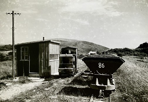
Weighbridge, Norden Clay Works (Photograph George Moon)
This building stands on the route of the narrow gauge railway that took clay to the Swanage Railway at Eldon Sidings on the far side of the level crossing, and to Poole harbour. It is made of cob, a traditional Dorset building material, a mixture of clay and stone.
The Norden clay works here was abandoned in the 1970’s and all clay processing moved to Furzebrook near Blue Pool. The sheds were subsequently demolished and the car park created as a transport hub.
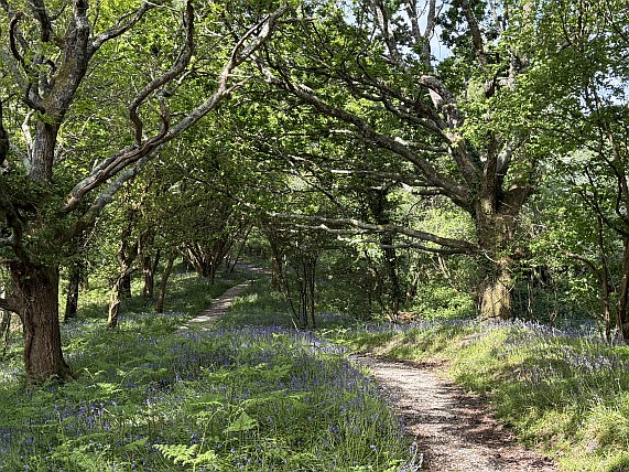
(Photograph Purbeck Mining Museum)
From the Cob building the trail crosses the car park and follows the route of the clay railway towards Poole Harbour. The railway had a gauge of 3 foot 9 inches, opening in 1907 and abandoned in 1937. In 1947 lines around the Norden clay works were re-gauged to 2 foot which meant the replacement of the old 3 foot 9 inch rolling stock and locomotives.
Clay Trail 2: Fayle’s Railway Engine Shed Site
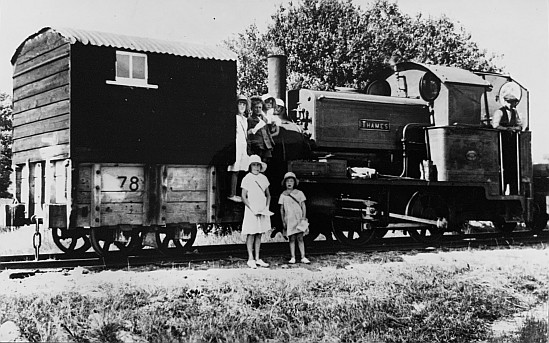
(Photograph S B Corbett)
This is the site of the Narrow Gauge Locomotive Engine Shed and the inspection pit (now filled in) with the original door restraining post and a section of 2 foot gauge track. Two rows of trees and a shallow cutting mark the track bed of Fayle and Companies 1907 railway to the Goathorn pier on Poole Harbour. This linked Norden to the clayworks at Newton, but was abandoned in 1937.
Before the second world war a rustic coach made from a clay wagon brought children on the railway to school in Corfe from the isolated hamlet of Newton, pictured here with the Surface children and ‘Thames’.
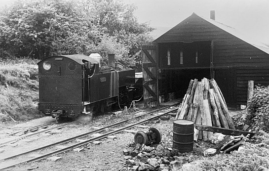
(Photograph Hugh Ballantyne)
Steam Locomotives that worked at Norden were called ‘Tiny’ and ‘Thames’. They were replaced by ‘Russell’ when the gauge was reduced from 3′ 9″ to 2′ in 1947. ‘Russell’, seen at the engine shed in this photograph by S W Baker, is now preserved on the Welsh Highland Heritage Railway.
Clay Trail 3: Blackwater Woodland Footpath
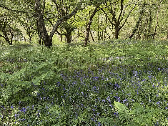
(Photograph Purbeck Mining Museum)
These woodlands and permissive footpath are managed by the Purbeck Mining Museum and owned by Swanage Railway. The permissive footpath was created in 2026 thanks to an award from Dorset Council Heathland Mitigation Fund in order to enhance the enjoyment of Purbeck Park for visitors. The path is an alternative route to Corfe Castle via the Blackwater clay pit.
Prior to ball clay extraction the area was predominantly heathland with pockets of wood pasture. The large oak trees nearby are over two hundred years old and survived on the edge of the clay pit.
The rising ground in front is formed of the sandy overburden from the clay pit that covered the valuable ball clay deposit beneath. The overburden was removed with shovels and barrows by men known as ‘lumpers’.
In spring the woodland is carpeted with bluebells followed by foxgloves, campions and stitchwort before the bracken takes over.
Clay Trail 4: Fayle’s Railway to Goathorn Pier
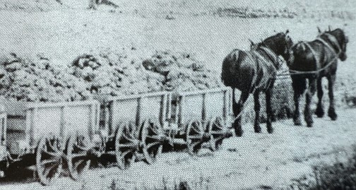
1806 horse drawn plate-way (Photograph Stoborough School)
Benjamin Fayle founded the Norden Ball Clay works about 1803 and supplied clay to Josiah Wedgwood for the production of fine china.
Below you is the railway cutting created in 1907. This line replaced the 1806 horse drawn plate-way that ran from Norden to Middlebere Quay on Poole Harbour; the earliest railway in Dorset. Behind you, through the trees, you can glimpse the Blackwater, a flooded open-cast ball clay mine.
Fayle’s railway connected clay workings at Norden with those at Newton. The pier at the Goathorn peninsular allowed clay from Norden to be shipped direct to sea going vessels.
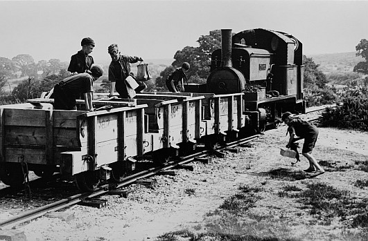
Scouts enjoy a trip on the line in 1935 (Photograph H G W Household)
Clay Trail 5: Corfe River Viewpoint
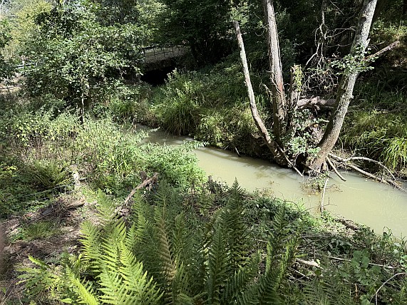
(Photograph Purbeck Mining Museum)
This is the valley of the Corfe River. The River flows from Corfe Common to Poole Harbour and is responsible for the gap in the chalk ridge guarded by Corfe Castle.
Fayle’s railway crossed the river valley at this point on a wooden trestle bridge. The 3 foot 9 inch gauge railway operated for 30 years. It was closed and lifted in 1937 as Poole harbour was prepared for possible invasion before World War II.
Here you can see an example of 3′ 9″ track and bridge portal reconstructed.
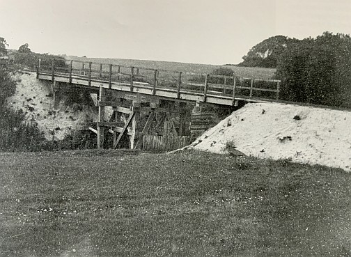
(Photograph B Fayle and Co)
The river passed through extensive clay workings in this area resulting in several lakes, now used for recreation and valuable for wildlife. It floods extensively during heavy rain
Clay Trail 6: Blackwater Bridge View Point
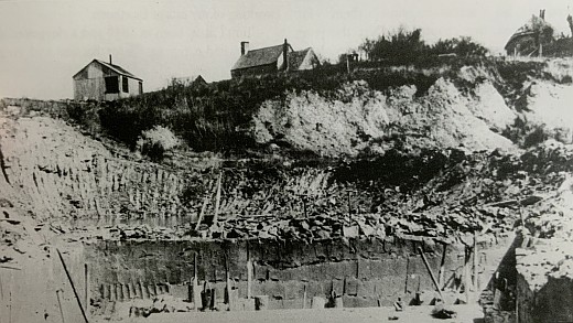
(Photograph Chris Legg)
The whole area was extensively mined for ball clay in the nineteenth and early twentieth century resulting in several abandoned and now flooded pits. This, now peaceful spot, is a great place to pause and watch for nature.
Unlike the famous Blue Pool, nearby, the Blackwater is a darker and more secluded lake because it is often flooded with fresh silt from the Corfe River in winter. The water is deep with soft mud around the edges so please do not enter and keep dogs and children safe.
The lakes on each side of the Corfe River, now occupied by the Dorset Adventure Park, were formerly the site of Arlfleet Mill. This was where corn was ground for flour since Medieval times. The Mill was destroyed by 1926 due to clay digging.
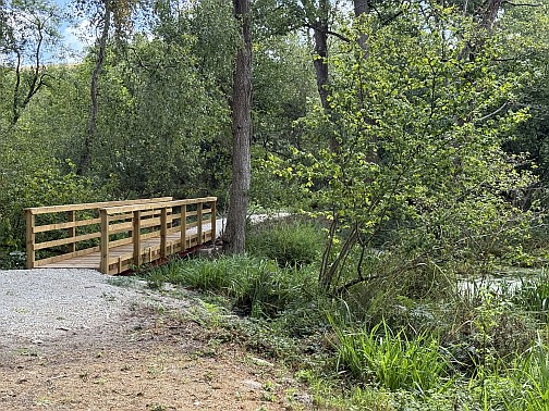
(Photograph Purbeck Mining Museum)
In this quiet and secluded place you may see Herons, Moorhens, Ducks and even a Kingfisher while you relax and enjoy the view.
Clay Trail 7: Corfe Castle View and Hazel Coppice
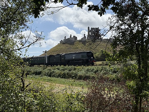
(Photograph Purbeck Mining Museum)
This high ground above the adjoining field is a huge heap of waste clay spoil. You can just make out the tip lines where the unwanted clay from the Blackwater pit was dumped.
The trees here are mostly old hazel that may have been deliberately planted then coppiced for making sheep hurdles and basketry. In coppicing the trees are cut to the ground to encourage new young growth that is harvested about every seven years.
From this ancient hazel coppice there are views of Corfe Castle, the Swanage Railway, and a good opportunity for photography.
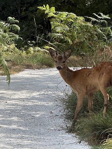
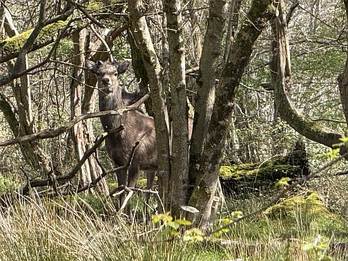
(Photographs Purbeck Mining Museum)
In the hazel woodland here you can often see both Sika Deer and native Roe Deer.
Clay Trail 8: Blackwater Woodland Footpath
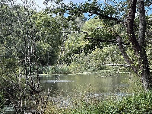
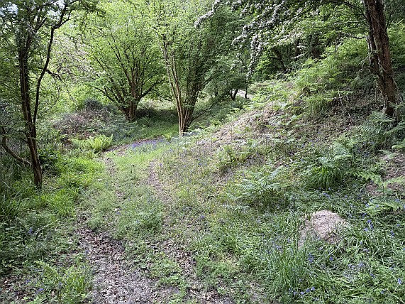
(Photographs Purbeck Mining Museum)
This woodland is managed by the Purbeck Mining Museum and owned by Swanage Railway. These permissive paths were created in 2026 thanks to an award from Dorset Council Heathland Mitigation Fund in order to enhance the enjoyment of Purbeck Park for visitors.
The path is an alternative route to Purbeck Park and Scotland Farm via the Blackwater clay pit. This damp, tree shaded woodland is an ideal habitat for ferns, mosses and lichens.
Prior to ball clay extraction this area was predominantly heathland with pockets of wood pasture. The raised ground in front of you comprises waste clay from the open cast clay pits.
Clay Trail 9: The Head Shunt Lookout
This is the highest point on the clay trail with a view into the tree canopy and the Blackwater clay pit below. The high ground is formed from clay waste brought over from clay mines at Norden Farm on the other side of the A351 and dumped into the worked out clay pit.
Behind is the track bed of the narrow gauge railway that brought the clay over the A351 road and the Swanage Railway to the Norden clay works. The clay works occupied what is now the Purbeck Park car park.
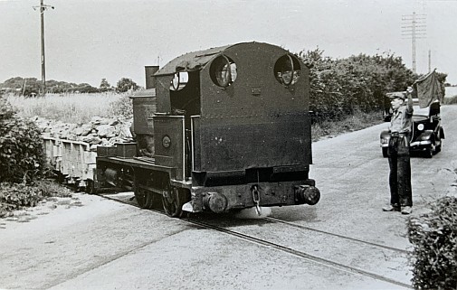
(Photographer unknown)
Clay train crossing the road on its way to the head shunt. The head shunt was used to reverse the train of clay trucks towards the lorry drop and exchange sidings on the Swanage Railway.
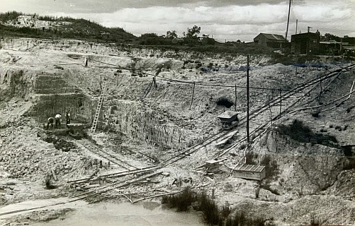
Typical hand worked open-cast clay pit, early 20th century at Newton (Photograph S W Baker)
Clay Trail 10: The Blackwater Viewpoint
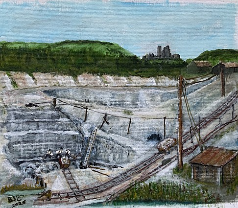
Painted re-imagination of the Blackwater clay pit by Purbeck Mining Museum volunteer Barry Cobb
The huge flooded ball clay pit below, known as the Blackwater, was excavated over a hundred years ago. The clay was extracted by hand and hauled out on clay wagons running on temporary tracks by a steam winch housed in a building near the railway. The pit is very deep and yielded many thousands of tons of clay before it was worked out.
Nature has now taken over with willow, birch and alder trees. Some much older oak trees survive around the pit perimeter.
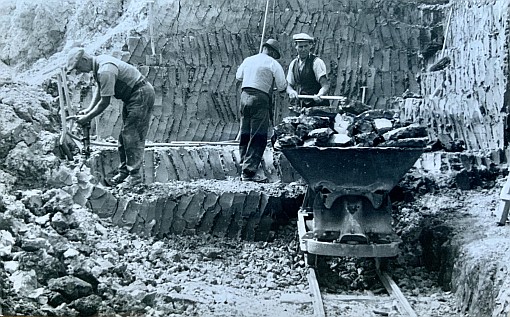
Hand digging ball clay (Photograph S W Baker)
Clay Trail 11: Skew Arch Bridge and Matcham’s Pit
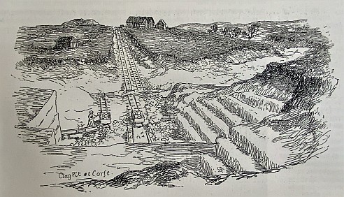
Matcham’s Pit; engraving from Robinson’s History of Dorset 1862
Matcham’s ball clay mine between the Railway and the A351 was worked in the mid 19th century. The clay was hauled out in clay wagons by a steam driven winch. When the Wareham to Swanage railway was built in the 1880s it passed through the Matcham’s pit winch line.
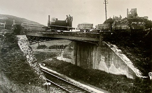
‘Tiny’ with clay train crossing Skew Bridge in 1938 (photograph R W Kidner)
The Skew Arch Bridge was built to enable the continued extraction of clay. Originally the bridge sloped down towards the pit on the far side. The angle of the slope can be seen in the supporting lattice steel girders.
When the clay in the pit was exhausted, new pits were opened at Norden Farm and a narrow gauge railway was built to bring the clay across to the Norden clay works. Earth and timber sleepers were added on top of the inclined bridge to level it for the new railway.
The temporary earth and timber structure was later replaced by the large steel girders now sitting above the sloping 19th century beams. Clay trains continued to cross the A351 road and bridge into the 1970s.
Clay Trail 12: Clay Railway and Lorry Drop
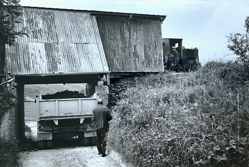
Lorry collecting ball clay from the clay train 1960s (Photograph George Moon)
The working narrow gauge railway in front of you has been laid on the original track bed of the line to the exchange sidings beyond the level crossing. Demonstration clay trains operate here on occasion.
The track sits on weathering beds where clay was left for about six months to break down. The Purbeck Mining Museum now occupies this site.
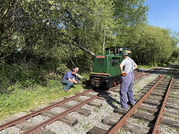
Purbeck Mining Museum demonstration narrow gauge railway (Photograph Purbeck Mining Museum)
From the railway station to the Purbeck Mining Museum and car park you pass through the Lorry Drop where clay was tipped from narrow gauge railway wagons into lorries, for transport by road in the later 20th century.
Clay Trail 13: Purbeck Mining Museum
The Purbeck Mining Museum opened in 2014 on the site of the Norden Clay works. Here you can explore the reconstructed No7 Underground Mine Building and equipment formerly at Norden Farm. This was the last working underground ball clay mine in Purbeck and closed in 1999.
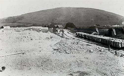
Norden Clay Works c1920 (Photograph Churchill of Wareham)
The Museum sits within a landscape of abandoned clay pits and spoil dumps, now mostly tree covered but, formerly, bare of all vegetation, as seen in this early photograph.
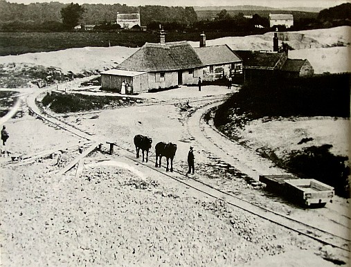
Norden Clay Works c1890s (Photograph Corfe Castle Museum)
To explore this landscape follow the signed trail from the car park. It is about one mile (1.5 km) of easy walking, with a few steep sections in places. The trail passes through areas of woodland and around a disused flooded clay pit, the Blackwater. Information boards at intervals explain features of the Industrial Archaeology and Nature Recovery.